Haryana completes drone flying target of 6286 villages, to become the first Lal Dora free state of the country
SGT Times Reporter
Chandigarh: With the completion of the drone flying target in 6286 Lal Dora villages, Haryana is set to become the first ‘Lal Dora’ free state in the country.
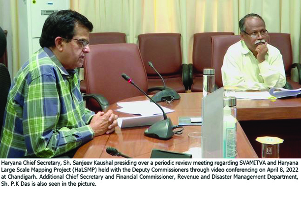
In a review meeting chaired by Chief Secretary Sanjeev Kaushal regarding SVAMITVA and Haryana, Large Scale Mapping Project (HaLSMP) held here today with the Deputy Commissioners through video conferencing it was informed that under SVAMITVA, to date more than 19 lakh property cards have been made. Besides this, the 30 days’ notice period for raising claims and objections invited under section 26 of the Haryana Panchayat Raj Act is also completed by April, 20.
It was further informed that by April 24 all the tasks under this scheme would also be completed.
Tasking the Deputy Commissioners to step up and double their efforts, Kaushal directed that every Deputy Commissioner should ensure 50 percent distribution of property cards in the next 10 days.
During the meeting, it was informed that Drone flying, Map-1 and Map-2 (including attribute collection) have been completed in all 6286 target Lal Dora villages and the work of Map-3 would be completed soon.
Besides this, the notification of claims and objections procedure, under section 26 of the Haryana Panchayat Raj Act has been notified for all target villages.
Till April 6, claims and objections of around 5737 villages have been addressed and the rest are under process. The figure of final maps that have been submitted to the Survey of India(SoI) is 5038.
It was also informed that directions have been issued to Deputy Commissioners to return final ownership data to SoI for 699 villages, where claims and objections have been completed, for the generation of a final map and land parcel map of each property.
The Chief Secretary was apprised that till now more than 19 lakh property cards have been prepared. Besides this, for the smooth issuance of property cards preparation and distribution by districts, required training was imparted to the technical staff of all the districts on how to generate property cards from the Land Parcel Map data.
Furthermore, the districts have been directed to share updates on the number of property cards prepared and distributed by them. Along with this, Development and Panchayats department has also been asked to share details of disputes.
Additional Chief Secretary and Financial Commissioner, Revenue and Disaster Management Department P.K Das, Mission Director, Lt. General Girish Kumar, Director, Survey of India, Col. Kunal, Director, Land Records Amna Tasneem also remained present in the meeting.


